Drone LiDAR Mapping & Survey Across the Gulf Coast
Classified Point Clouds • Bare-Earth DTMs • CAD-Ready Surfaces
Gulf Coast LiDAR mapping with the DJI Matrice 400 and Zenmuse L3 for utility corridors, pipelines, solar sites, and earthworks.
Baton Rouge Drones delivers professional, customized aerial solutions built on accuracy, safety, and clear communication. We provide reliable data and practical results while making complex projects easier to manage.
Here to Serve. Here to Solve. Here to Streamline.
Aerial LiDAR Mapping for Vegetated Sites and Long Corridors
Baton Rouge Drones provides aerial LiDAR mapping across the Gulf Coast using the DJI Matrice 400 and Zenmuse L3. We capture dense, multi-return point clouds that penetrate vegetation to produce classified point clouds, bare-earth digital terrain models (DTMs), and CAD-ready surfaces for projects that need accurate ground data without walking every foot of corridor or site.
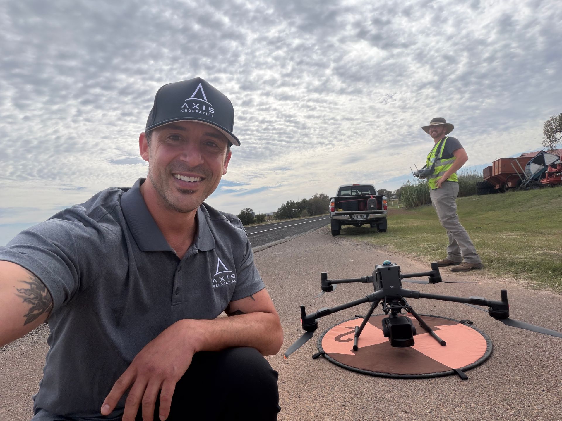
Ideal Applications for Drone LiDAR Survey
Ideal applications include:
Utility and transmission corridor mapping
(overhead lines, distribution routes, substations)
Utility corridor mapping and transmission corridor LiDAR.
Pipeline and right-of-way (ROW) surveys
Pipeline corridor survey data without walking every foot.
Utility and transmission corridor mapping
(overhead lines, distribution routes, substations)
Utility corridor mapping and transmission corridor LiDAR.
Civil engineering and earthworks: cut-and-fill volumes, stockpile measurement, site grading verification
Earthworks volume LiDAR for engineers and owners.
General contractors and dirt-work companies needing fast surface models
Quick turnaround surface models for active jobs.
LiDAR Deliverables: Classified Point Clouds, Bare-Earth DTMs & CAD-Ready Data
Deliverables we provide:
- Classified point clouds (ground, vegetation, structures, wires)
- Classified point clouds (ground, vegetation, structures, wires)
- Formats ready for Civil 3D, MicroStation, PLS-CADD, GIS, and other engineering workflows
- Classified point clouds (ground, vegetation, structures, wires)
- Classified point clouds (ground, vegetation, structures, wires)
- Formats ready for Civil 3D, MicroStation, PLS-CADD, GIS, and other engineering workflows
LiDAR vs. Photogrammetry: Which Drone Survey Fits Your Site?
Photogrammetry builds a surface from overlapping photos, so it models whatever is visible from above. LiDAR measures laser returns, and some of those returns reach the ground through gaps in vegetation. That is why a drone LiDAR survey is the better fit when true ground elevation matters. We can help you pick the right method for your project.
Choosing between drone LiDAR and photogrammetry
| Project need | Drone LiDAR | Photogrammetry |
|---|---|---|
| Bare-earth DTM under vegetation | Best fit. Multi-return pulses can reach the ground through canopy gaps. | Limited. Models the visible surface, so brush and treetops can read as ground. |
| Utility, transmission and pipeline corridors | Best fit. Captures wires, structures and ground in one pass for classification. | Useful for imagery, but thin lines and ground under cover are harder to capture. |
| Solar and BESS grading and drainage | Best fit on vegetated or uneven ground where ground levels drive design. | Works well on open, bare ground with good surface texture. |
| Stockpile and earthworks volumes | Strong choice for surface models and cut-and-fill. Dual RGB cameras add imagery. | Often sufficient on open sites with clear texture. |
Results depend on site conditions such as vegetation density, season, standing water, and surface type. We tell you up front what to expect for your site.
LiDAR vs. Photogrammetry: Which Drone Survey Fits Your Site?
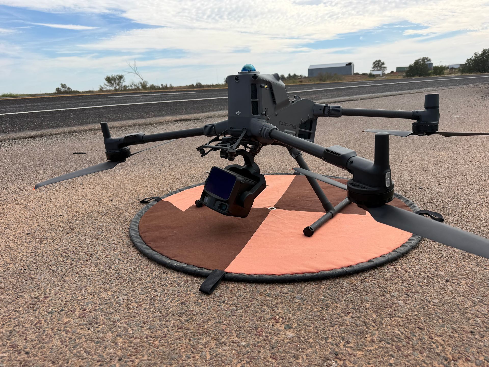
Our Gulf Coast LiDAR mapping program is built around a purpose-built enterprise aircraft and sensor.
AIRCRAFT
DJI Matrice 400
An enterprise multirotor platform that carries the Zenmuse L3 and flies the corridors, industrial sites, and remote tracts where we do most of our LiDAR work.
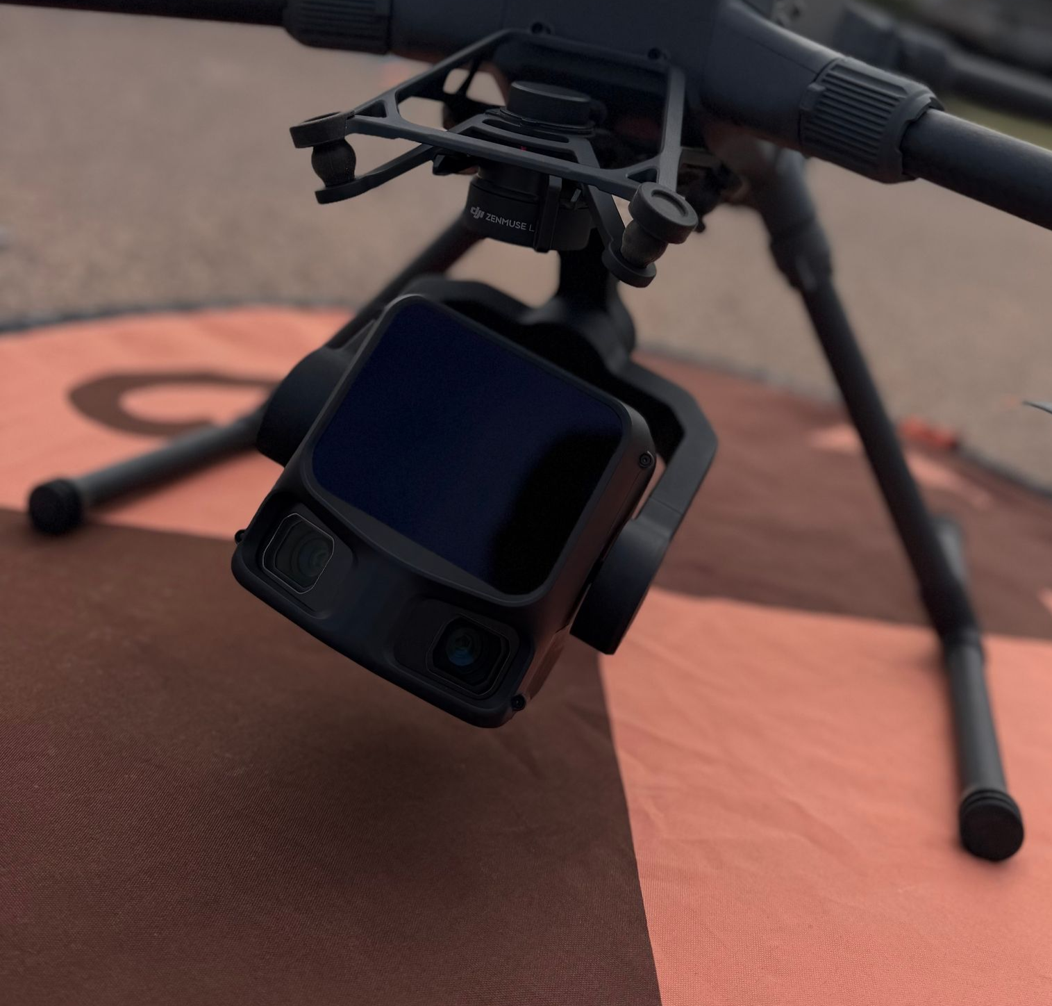
SENSOR
DJI Zenmuse L3
Captures dense, multi-return point clouds that penetrate vegetation, plus RGB imagery from dual 100 MP cameras for orthomosaics and visual context.
How Our Drone LiDAR Survey Process Works
A clear workflow from first call to engineering-ready data.
Scope
Tell us about your site or corridor, what you will design or measure, and the formats your team uses.
Plan & Control
We plan flights around site access and safety requirements and set ground control to check the data.
Capture
Our certified pilots fly the Matrice 400 and Zenmuse L3 to capture the point cloud and RGB imagery.
Process & Deliver
We classify the point cloud, build the DTM and surfaces, and deliver files with accuracy reporting against ground control.
Certified, Insured, and Safe on Industrial Sites
We operate with FAA Part 107 certification plus TWIC, MSHA, and OSHA credentials, so we can work safely on industrial sites, energy infrastructure, and remote corridors across Louisiana, Mississippi, and the surrounding region.
When a project requires licensed surveyor oversight, stamped deliverables, or certification, we regularly partner with Professional Land Surveyors and can coordinate that support.
LiDAR Mapping FAQs
If you don't see the information you need, feel free to reach out to us.
What is a drone LiDAR survey?
A drone LiDAR survey flies a laser scanner on a UAV and records the time of every returned pulse to build a dense, georeferenced point cloud. Because a single pulse can return from the canopy and the ground, the point cloud can be classified into ground, vegetation, structures and wires, producing a bare-earth DTM as well as a surface model.
When should I choose LiDAR instead of photogrammetry?
Choose LiDAR when you need true ground elevation beneath vegetation, when you are mapping long utility, transmission or pipeline corridors, or when a classified point cloud is the main deliverable. Photogrammetry models the visible surface only, so it can show treetops and brush as ground. For open, low-vegetation sites with good surface texture, photogrammetry may be all you need, and we can advise on which fits your project.
Can LiDAR map the ground through vegetation?
Often, yes. Multi-return LiDAR records pulses that reach the ground through gaps in the canopy, which is how we produce bare-earth DTMs on vegetated sites. Results depend on how dense the vegetation is and on the season, so very dense cover can leave fewer ground points. We verify the ground model against ground control and report accuracy.
What deliverables do I receive from a LiDAR mapping project?
Typical deliverables include classified point clouds (ground, vegetation, structures and wires), bare-earth DTMs and DSMs, contours, cross-sections and breaklines, orthomosaics and RGB imagery from the dual 100 MP cameras, formats ready for Civil 3D, MicroStation, PLS-CADD and GIS workflows, and accuracy reporting against ground control.
Do you provide stamped or certified survey deliverables?
When a project requires licensed surveyor oversight, stamped deliverables or certification, we regularly partner with Professional Land Surveyors and can coordinate that support.
What areas do you serve for LiDAR mapping?
We provide Gulf Coast LiDAR mapping across Louisiana, Mississippi and the surrounding region, including industrial sites, energy infrastructure and remote corridors. We hold FAA Part 107 certification plus TWIC, MSHA and OSHA credentials.
Get Your Gulf Coast LiDAR Mapping Quote
Contact us or call
(225) 224-3277 or schedule a consultation.